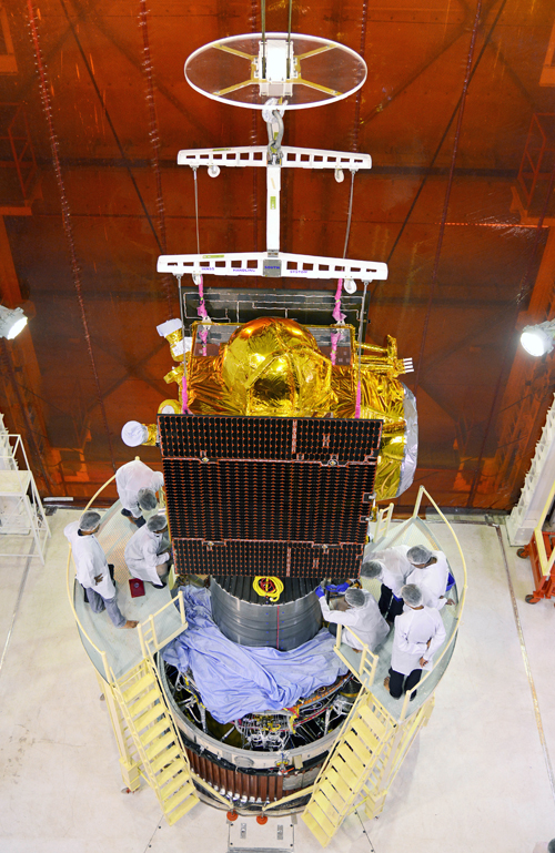
IRNSS-1C will be the third out of seven in the Indian Regional Navigational Satellite System (IRNSS) series of satellites slated to be launched to provide navigational services to the region. By next year all the seven satellites are planned to be in space.
The first two satellites in the series, IRNSS 1A and IRNSS 1B, were launched from Sriharikota on July 1 last year and April 4 this year respectively.
The satellite will be placed in geosynchronous orbit by the launch vehicle PSLV-C26. The launch has been scheduled on October 9 (02:00 am) and the countdown will begin from October 6 at Sriharikota, Andhra Pradesh.
The satellite is powered by two solar arrays, which generate power up to 1,660 watts, and has a life-time of ten years.
IRNSS-1C satellite will have two payloads: a navigation payload and CDMA ranging payload in addition with a laser retro-reflector. The payload generates navigation signals at L5 and S-band.
With a position accuracy of better than 20 meters in the 1500 kilometers area covering the Indian peninsula, IRNSS will provide Standard Positioning Service and Restricted Service.
The navigational satellite will also provide terrestrial, aerial, and marine navigation accurately and help disaster management, vehicle tracking and fleet management, mobile phone tracking, mapping of terrain as well as air and sea navigation.
IRNSS is similar to US’ Global Positioning System (GPS), Russia’s Glonass and Europe’s Galileo. China and Japan are also having similar systems named Beidou and Japanese Quasi Zenith Satellite System respectively.


