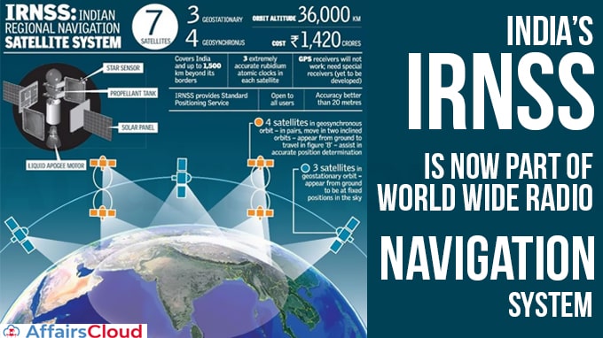
 The Indian Regional Navigation Satellite System (IRNSS) (operational name NavIC – Navigation with Indian Constellation) has been accepted as a component of the World Wide Radio Navigation System (WWRNS) for operation in the Indian Ocean Region (IOR) by the International Maritime Organization (IMO). India became the Fourth Country in the world to have its independent regional navigation satellite recognised by IMO.
i.The Other three countries are the United States (US), Russia and China.
ii.The Maritime Safety Committee (MSC) of IMO approved the recognition of IRNSS as a component of the WWRNS during its meeting (102nd session) held from November 4-11, 2020.
Importance:
i.The recognition will enable merchant vessels to use IRNSS to obtain position information similar to Global Positioning System (GPS) of US, & Global Navigation Satellite System (GLONASS) of Russia.
ii.At least 2, 500 merchant vessels in Indian waters can now use IRNSS.
iii.IRNSS will be used to assist in navigation of ships in ocean waters within the area of approximately 1, 500 km from Indian Boundary(i.e. 50°N latitude, 55°E longitude, 5°S latitude and 110°E longitude).
iv.Directorate General of Shipping (DGS) under the Ministry of Ports, Shipping and Waterways initiated the matter with the IMO.
Indian Regional Navigation Satellite System (IRNSS):
i.IRNSS was developed by ISRO (Indian Space Research Organization). The Government of India approved the project in May, 2006.
ii.It was developed with an objective to implement an independent and indigenous regional spaceborne navigation system for national applications.
iii.The proposed IRNSS system consists of a constellation of Eight satellites and a supporting ground segment.
Background:
IRNSS was developed because access to foreign government-controlled global navigation satellite systems is not guaranteed in hostile situations, as happened to the Indian military in 1999 when it was dependent on the American Global Positioning System (GPS) during the Kargil War.
Recent Related News:
i.Maritime Union of India (MUI) has collaborated with the United Nations to assist seafarers who are stranded on ships due to COVID-19 Pandemic.
About International Maritime Organisation (IMO):
Secretary-General – Kitack Lim
Headquarters – London, United Kingdom


