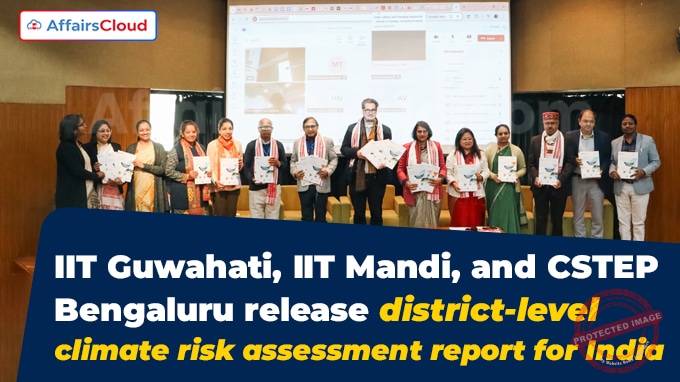
 In December 2024, Indian Institute of Technology (IIT)Guwahati (Assam) in partnership with IIT Mandi (Himachal Pradesh, HP) and Bengaluru (Karnataka)-based Centre for Study of Science, Technology, and Policy (CSTEP), developed and released the report titled “District-Level Climate Risk Assessment for India: Mapping Flood and Drought Risks Using the Intergovernmental Panel on Climate Change (IPCC) Framework” at IIT Delhi in New Delhi (Delhi).
- The report provides comprehensive in-depth analysis of flood and drought risks across 698 districts in India.
- The report was prepared with the support of the Department of Science and Technology (DST) under the Ministry of Science and Technology(MoS&T) in partnership with the Swiss Agency for Development and Cooperation (SDC).
Key People:
i.The report was released by Dr. Anita Gupta, Head of Scientific Divisions, DST; Pierre-Yves Pitteloud, Senior Regional Advisor on Disaster Risk Reduction (DRR), Climate Change Adaptation (CCA) and Rapid Response (RR)in South Asia, SDC, Embassy of Switzerland among others.
ii.Key researchers who contributed to the report like: Prof. N.H. Ravindranath from Indian Institute of Science (IISc) Bengaluru, Karnataka; Dr. Indu K. Murthy from CSTEP; Dr. Shyamasree Dasgupta, IIT Mandi and Dr. Anamika Barua, IIT Guwahati, along with other senior officials from DST, Ministry of Environment, Forest and Climate Change (MoEF&CC) and other stakeholders were also present at the event.
Key Findings:
i.The report provides district-level flood and drought hazard, exposure, and vulnerability maps, which helped in creating comprehensive flood and drought risk maps for India.
- In addition to the report, a detailed user manual was also released during the event.
ii.The report has placed 51 districts into the ‘Very High’ flood risk category, and 118 districts into the ‘High’ flood risk category.
- Among these districts, about 85% are in Assam, Bihar, Uttar Pradesh (UP), West Bengal (WB), Gujarat, Odisha, and Jammu & Kashmir (J&K).
iii.The report has further classified 91 Indian districts in the ‘Very High’ drought risk category and 188 districts in the ‘High’ drought risk category. Among these districts, over 85% are located in Bihar, Assam, Jharkhand, Odisha, UP, Maharashtra, WB, Karnataka, Tamil Nadu (TN), Chhattisgarh, Kerala, Uttarakhand, and Haryana.
iv.Among the top 50 districts with highest flood risk as well with highest drought risk, 11 Indian districts, including: Patna (Bihar); Alappuzha (Kerala); Kendrapara(Odisha); Murshidabad, Nadia and Uttar Dinajpur (WB); Charaideo, Dibrugarh, Sibsagar, South Salmara Mankachar, and Golaghat (Assam) are at ‘Very High’ risk for both floods and droughts, and emphasized on necessary immediate interventions.
Other Key Points:
i.The report has used the IPCC framework to identify the challenges posed by floods and droughts and highlighted their impact on vulnerable populations.
ii.The report was based on the previously released Climate Change Vulnerability Map for Himalayan states, prepared by the same team in 2019.
iii.The report underscored the importance of capacity building at the state level, consisting of climate change cells and allied departments with tools and methodologies for integrating risk assessments into their adaptation strategies.
iv.The key findings of the report will help the state governments to integrate climate risk assessments into the State Action Plan on Climate Change (SAPCC). It further highlighted the significance of addressing emerging risks like: heat stress and landslides and adding them into risk assessments to strengthen preparedness and resilience.
Recent Related News:
According to the Central Water Commission (CWC)’s report released in November 2024, glacial lakes and other water bodies across the Himalayan region witnessed an overall increase of 10.81% in areas, from 5.33 lakh hectares (ha) in 2011 to 5.91 lakh ha in 2024 due to climate change, which indicates towards increased risk of Glacial Lake Outburst Floods (GLOFs).
- As per the report, the total inventory area of glacial lakes in India has increased by 33.7% i.e. from 1,962 ha during 2011 to 2,623 ha during 2024 (September).


