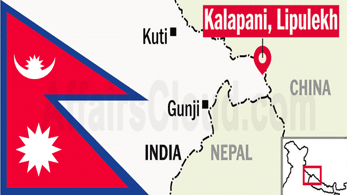
 On May 19, 2020, Amidst the border dispute with India, Nepal’s cabinet has accepted a new political map showing Lipulekh, Kalapani and Limpiyadhura under its territory. The new map shows the northern, southern, eastern and western international borders of Nepal. The politics and administrative systems of the areas adjacent to these borders are also mentioned.
Key Points:
i.Nepal’s Finance Minister Pradeep Gyawali announced the release of the new map, which was placed in the Council of Ministers meeting chaired by Prime Minister (PM) KP Sharma Oli, where it was approved.
ii.The Lipulekh Pass is a remote western place near the disputed border between Nepal and India, Kalapani . Both India and Nepal consider Kalapani as their integral part. India calls it part of Pithoragarh district of Uttarakhand while Nepal is part of Dharchula district.
iii.Background:
- India and Nepal are at a dispute after the Indian side released its new political map on 2 November 2019, which covers Kalapani, Limpiyadhura and Lipulekh areas in Indian territory.
- The tension further increased after Indian Defense Minister Rajnath Singh inaugurated a 80km road link connecting Kailash Mansarovar, a holy pilgrimage site situated at Tibet, China, that passes through the territory belonging to Nepal.
iv.Since when and why is there a dispute?
- The Sugauli Treaty of 1816 was signed between Nepal and the British East India Company in 1816 after the Anglo-Nepal War. It depicts the Kali (Mahakali) river as the western border of India and Nepal. On the basis of this, Nepal claims to be under the jurisdiction of Lipulekh and other three regions.
- However, the situation regarding the border between the two countries is unclear. Both countries have their own maps showing the disputed area under their jurisdiction.
- It is to be noted that India and Nepal share 1,800 kilometers (1,118-mile) of open border.
About Nepal:
Capital– Kathmandu
Currency– Nepalese rupee
President– Bidhya Devi Bhandari


