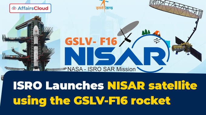
 On July 30, 2025, the Indian Space Research Organisation (ISRO) successfully launched the NASA-ISRO Synthetic Aperture Radar (NISAR) satellite aboard the Geosynchronous Satellite Launch Vehicle (GSLV)-F16 rocket from Satish Dhawan Space Centre (SDSC), Sriharikota, Andhra Pradesh (AP).
- This marks the first-ever joint Earth observation mission between ISRO and the National Aeronautics and Space Administration (NASA) of the United States of America (USA), with a joint investment exceeding USD 1.5 billion over 10+ years of development.
- It is the world’s first radar imaging satellite to operate with dual-frequency bands, L-band and S-band on a single platform, enabling accurate monitoring of the cryosphere, ecosystems, and solid Earth processes.
- This mission marked the 18th launch of the GSLV and the 12th using India’s indigenous cryogenic upper stage.
Exam Hints:
- What? NISAR satellite launched for Earth observation.
- Launched from: Satish Dhawan Space Centre (SDSC), Sriharikota, Andhra Pradesh (AP)
- vehicle: Geosynchronous Satellite Launch Vehicle (GSLV)-F16
- Developed by: ISRO and NASA (USA)
- Uniqueness: 1st satellite fitted with two SARs (L-band & S-band)
- Orbit: Sun-Synchronous Polar Orbit (SSPO) at approximately 747 km altitude
- Objective: To provide high-resolution, all-weather, day-and-night imagery of Earth’s surface every 12 days
- Mission duration: 5 years
About NISAR Satellite:
Objective: The mission aims to provide high-resolution, day-and-night, all-weather imagery across a 242-kilometer (km) swath, scanning nearly all of Earth’s land and ice surfaces every 12 days. It will systematically monitor:
- Ecosystem Changes: Woody biomass, cropland extent, wetlands, and soil moisture.
- Cryosphere: Monitoring glacier retreat, sea ice, and ice sheets in Greenland and Antarctica.
- Geohazards: Studying earthquakes, volcanic activity, landslides, and land subsidence.
- Ocean & Disaster Management: Enabling storm tracking, flood mapping, shoreline erosion, and real-time disaster response.
NISAR Specifications:
Total Mass: Approximately 2,392 kilograms (kg)
Orbit Type: Sun-synchronous polar orbit at an altitude of around 747 kilometers (km), circling Earth 14 times daily.
Mission Duration: Designed for a 5-year mission life, with consumables supporting around 3 years of active operations
Payload:
NASA’s Contributions: L-band SAR (24-centimeter (cm) wavelength radar), developed by Jet Propulsion Laboratory (JPL), featuring a 12-meter (m) reflector antenna, 9 m deployable boom.
- Global Positioning System (GPS) receivers, the solid-state recorder, and a high-rate telecommunications subsystem.
ISRO Contributions: S-band SAR (12 cm wavelength), the I-3K satellite bus with around 2,400 kg lift-off mass.
- Spacecraft platform, data handling and downlink systems, and the GSLV-F16 launch vehicle and associated services.
- The S-band radar was built by Ahmedabad (Gujarat)-based Space Applications Centre (SAC).
Imaging Technology:
NISAR employs the SweepSAR technique, enabling wide-swath imaging with high-resolution radar capability under all weather and lighting conditions.
- Detects surface changes as small as 0.4 inches (1 cm) vertically.
Three-axis stabilization: NISAR satellite is designed to be three-axis stabilized. This means it uses reaction wheels to maintain its orientation towards Earth and the Sun, ensuring the radar instruments and solar panels are correctly positioned.
Phases of Mission:
Launch Phase: Completed on 30th July 2025. The satellite reached its orbit within 19 minutes of launch.
Deployment Phase: The 12 m mesh reflector antenna will be deployed via a 9 m boom within a few days after launch.
Commissioning / In-Orbit Checkout (IOC): A 90-day calibration and commission phase during which corner reflectors hosted by the National Centre of Geodesy at Indian Institute of Technology (IIT)-Kanpur (Uttar Pradesh, UP) and IIT-Patna (Bihar) support radar calibration and course correction for high precision data accuracy.
Science Operations Phase: Begins after commissioning (Around Day 90) and continues until the end of mission life. Jointly managed by NASA and ISRO, this phase includes regular observation planning, orbit corrections, and ongoing calibration (CalVal) activities.
Global Impact:
Data Accessibility: All NISAR data will be freely available, aiding global scientific research, developing countries, and disaster management agencies.
Technological First: First time GSLV places a satellite into sun-synchronous orbit.


