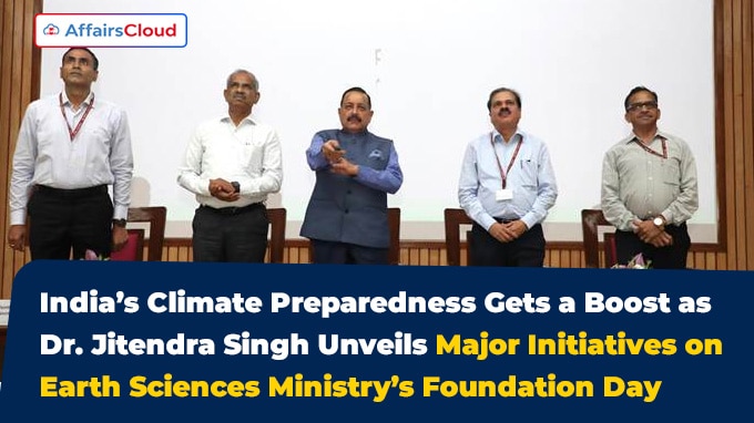
 On July 28, 2025, the Ministry of Earth Sciences (MoES), celebrated its 19th Foundation Day in New Delhi, Delhi. During the event, Union Minister of State (MoS) (Independent Charge, IC) Dr. Jitendra Singh, MoES, unveiled 14 scientific products and digital services developed by the MoES, aimed at enhancing India’s climate resilience and public safety.
- Among the key initiatives unveiled were the Bharat Forecast System – Extended Range Prediction (BharatFS-ERP), wave atlases, seismic microzonation maps, marine weather forecasting tools, oceanographic data services, and a range of scientific datasets.
- He also released the India Meteorological Department’s (IMD) documentary titled ‘Life Saving Impact’, highlighting how timely weather alerts and forecasts help protect lives.
Key People:
The event witnessed the presence of key officials including Dr. M. Ravichandran, Secretary, MoES; D. Senthil Pandiyan, Joint Secretary, MoES; Dr. Mrutyunjay Mahapatra, Director General(DG), IMD; and Prof. Dev Niyogi, Guest of Honour and UNESCO Chair at the University of Texas.
Key Initiatives Launched:
BharatFS-ERP: Bharat Forecast System – Extended Range Prediction (BharatFS-ERP) provides advanced weather forecasts, helping users access timely and reliable information.
Wave Atlases: Updated wave atlases and seabed charts aim to support safe and efficient marine navigation.
Seismic Microzonation Maps: Risk assessment maps for four Indian cities, detailing earthquake hazards to support urban planning and disaster mitigation.
- The 4 Indian cities are Guwahati(Assam), Dehradun(Uttarakhand), Surat (Gujarat) and Thiruvananthapuram(Kerala).
Marine Weather Forecasting Tools: Specialized services for coastal and marine weather prediction to support fisheries and shipping industries.
Oceanographic Data Services: Tools to monitor ocean parameters such as temperature, salinity, and currents, supporting marine ecosystem and resource management.
Scientific Datasets:These include high-resolution rainfall datasets and crop-weather calendars that provide detailed weather and climate information.
- Crop-Weather Calendars: Customized calendars to help farmers plan sowing, irrigation, and harvesting based on weather forecasts.
- Rainfall Monitoring Systems: Real-time systems that track rainfall patterns to support water resource management and flood forecasting.
- High-Resolution Rainfall Data Atlas: Detailed datasets offering precise rainfall distribution maps to aid in climate research and agricultural planning.
- Advanced Weather Forecasting Models: Enhanced computational models for more accurate and timely weather predictions.
- Climate Change Impact Assessment Tools: Systems to evaluate the effects of climate change on various sectors, aiding policy and adaptation strategies.
- Real-Time Disaster Warning Systems: Early warning platforms for cyclones, floods, and other natural disasters to reduce risks to lives and property.
- Lightning Detection Network Enhancements: Upgraded systems to monitor and predict lightning activity, improving safety measures.
- Upper Air Observation Systems: Advanced atmospheric monitoring tools to collect data on weather systems and enhance forecast accuracy.
- Digital Public Service Platforms: User-friendly digital portals providing accessible climate and weather information to the public and stakeholders.
Infrastructure Expansion Over the Decade:
Doppler Weather Radars(DWRs): The number of DWRs increased from 15 (in 2014) to 41 (in 2025), enhancing real-time weather monitoring.
Infrastructure: Seismic stations, weather observatories, lightning detection networks, and rain gauges have all more than doubled in number.
Faster Earthquake Alerts: Now issued within 2–3 minutes of tremors, and are instantly accessed by millions of users online.
Cyclone Forecasting: Cyclone warning lead time extended to 10 days, drastically reducing casualties.
Sector-Specific Impacts:
Agriculture: Over 7 lakh farmers use the Meghdoot app for weather-based advisories on sowing and irrigation.
Fisheries: Coastal communities receive daily Short Message Service (SMS) alerts for safe fishing zones.
Water Security: Six Ocean Thermal Energy Conversion (OTEC) plants in Lakshadweep supply 1.5 lakh litres of potable water daily, ending centuries of water scarcity
Exploring the Ocean Depths:
India’s Deep Ocean Mission, with the Samudrayaan project, aims to send humans 6 kilometers (km) below sea level by 2026, mirroring the Gaganyaan space mission (“One up, one down”).
- The Deep Ocean Mission was launched in 2021 to explore India’s exclusive economic zones and continental shelf through advanced marine technologies. The mission is budgeted at approximately Rs.4,077 crore (2021–26).
About Ministry of Earth Sciences (MOES):
Union Minister of State (MoS) (Independent Charge, IC)- Dr. Jitendra Singh (Constituency-Udhampur, Jammu & Kashmir, J&K)


