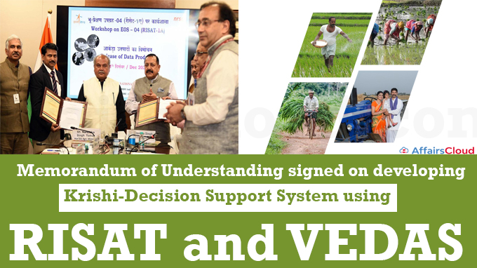
 A Memorandum of Understanding (MoU) was signed by the Department of Agriculture and Farmers Welfare (DA&FW), Ministry of Agriculture and Farmers Welfare (MoA&FW), and the Department of Space (DOS) to develop the Krishi-Decision Support System (Krishi-DSS).
- The Krishi-DSS will be developed using geospatial technology and associated databases to enhance the capability of all agricultural stakeholders to make evidence-based decisions.
Backdrop
- The MoU was signed at the official release of the data products and services of the Radar Imaging Satellite (RISAT)-1A satellite for the user community in New Delhi, Delhi.
- It was jointly released by Union Minister Narendra Singh Tomar, MoA&FW, and Union Minister of State (MoS), Dr. Jitendra Singh, DOS.
Key Points:
i.The MoA&FW is developing Krishi-DSS, a decision support system modelled after Gati Shakti, using RISAT-1A and the Visualization of Earth Observation Data and Archival System (VEDAS) of DOS.
- This would improve the evidence-based decision-making capabilities of all agriculture stakeholders through integration with MOSDAC (Meteorological and Oceanographic Satellite Data Archival Centre); BHUVAN, the geo-platform of the Indian Space Research Organisation (ISRO); and the systems of the Indian Council of Agricultural Research (ICAR).
ii.The DA&FW is also working on AgriStack, a set of technologies and digital databases targeted at Indian farmers and the agricultural sector that was proposed by the Central Government.
iii.In compliance with the SVAMITVA scheme, over 6 lakh Indian villages will be surveyed using geospatial technologies & drones, and 100 Indian cities will also receive Pan-India 3D maps at the same time.
iv.The Trinity of – Geospatial Systems, Drone Policy, and the Unlocked Space Sector will revolutionize Indian agriculture by increasing farmer income and achieving the target of a USD 5 trillion economy.
RISAT-1A
i.RISAT-1A, India’s first radar imaging satellite, was launched on February 14, 2022.
ii.It is an all-weather satellite that can take high-resolution geospatial images regardless of lighting conditions and can penetrate deeper into vegetation.
- It provides unique radar images, which are high-end, strategic technology primarily used for defence, but will now be widely employed in agriculture.
iii.The National Remote Sensing Centre (NRSC), Hyderabad (Telangana), receives, processes, and disseminates RISAT-1A data through its Bhoonidhi Geoportal.
ISRO’s Earth Observation Datasets – VEDAS, Bhuvan, IRNSS & MOSDAC
Visualisation of Earth Observation Data and Archival System (VEDAS)
VEDAS is an online geo-processing platform that uses Earth Observation (EO) data from optical, microwave, thermal, and hyperspectral sources for applications primarily intended for education, research, and problem-solving.
Bhuvan
The national geo-portal known as Bhuvan, developed and administered by ISRO, includes tools for analysis as well as geospatial data and services.
Indian Regional Navigation Satellite System (IRNSS)
ISRO developed India’s own navigation system, IRNSS (Indian Regional Navigation Satellite System), also known as NavIC (Navigation with Indian Constellation).
Meteorological and Oceanographic Satellite Data Archival Centre (MOSDAC)
MOSDAC, which deals with weather-related data, oceanography, and tropical water cycles, is a data archive for all of ISRO’s meteorological missions.
Recent Related News:
i.In November 2022, Radar Imaging Satellite-2 (RISAT-2) made an uncontrolled re-entry into the Earth’s atmosphere at the predicted impact point in the Indian Ocean near Jakarta, Indonesia.
ii.RISAT-2, weighing 300 Kg, was launched by the Indian Space Research Organisation (ISRO) using the Polar Satellite Launch Vehicle (PSLV -C12 launch vehicle) in 2009. It was designed to last for 4 years.
About the Indian Space Research Organisation (ISRO):
Chairman – S. Somanath
Headquarters – Bengaluru, Karnataka
Establishment – 1969


